Queensland’s Far North is on cyclone watch as it prepares for Tropical Cyclone Jasper to make landfall.
The system remains a category 2 and is situated 880km east of Port Douglas and 850km east of Cairns, according to the latest tracking map from the Bureau of Meteorology.
“The system is moving in a general westwards direction at 14 kilometres per hour,” BOM said.
Jasper is expected to maintain intensity during Monday and Tuesday before intensifying to a category 3 cyclone shortly before making landfall on Wednesday, most likely between Cooktown and Cardwell.
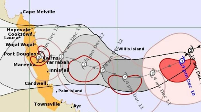
“Damaging winds are expected to develop along the Queensland coast between Cooktown and Ingham, including Cairns from Tuesday and may extend as far south as Townsville or as far north as Cape Melville depending on Jasper’s movement,” the weather bureau said.
“Heavy rainfall is expected to develop along the coast from late Tuesday.
“As the cyclone approaches the coast, abnormally high tides are possible and large waves are likely along the coast”.
The bureau has urged residents in those areas to review their cyclone plan.