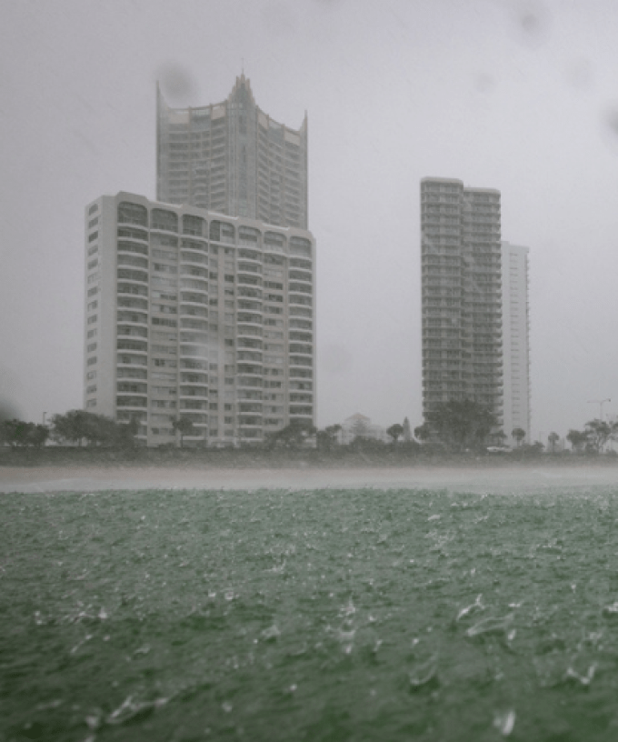
Gold Coasters are being urged to keep an eye on the radar today, with possible severe thunderstorms expected to lash the city.
It comes after parts of the coast copped a downpour over the last 24 hours, with 50mm to 70mm of rain recorded in multiple inland suburbs.
However, the Bureau of Meteorology warns today will be even riskier, with thunderstorms expected to develop throughout the afternoon and evening due to a low-pressure trough.
“What we saw yesterday was less thunderstorms and more areas of showers and steady rain,” Meteorologist Miriam Bradbury told Hot Tomato.
“The thing that’s going to set this afternoon apart is the period of time that the rainfall is going to come through.
“We’re expecting short, sharp downbursts of rainfall and when it falls in a really short space of time, that’s when we can see flash flooding developing.
Ms Bradbury added that the storms could be hit and miss, depending on where you live.
“It’s going to be localised to where those storms develop, so it’s going to be one of those days where if you get rain, it’s going to be quite a lot of rain if the storm is directly overhead.
“But if you’re sitting on the outskirts of that storm you will get that much lower rainfall total and not see that extreme weather.
Gold Coasters may also want to park their cars undercover, with fears the storms could pack some hail.
“I think the thing we need to remember is damaging winds and large hail can still happen with the storms, as well as the rainfall, and they themselves can be quite dangerous,” Ms Bradbury said.
“These storms can be a little bit hit and miss so the best way to track where they are is by having a look on the radar”.
We’ll get a short reprieve from the wet weather tomorrow, before the rain and storms return on Friday.
“We are expecting a much finer day tomorrow with mostly clear skies,” Ms Bradbury said.
“There is a very slight chance we could hear a rumble of thunder throughout the afternoon, but it’s a much lower chance than today and it will be much warmer with a top of 34 degrees.
“It is possible we could see further severe storms develop on Friday and across the weekend as well.
“Those rainfall totals over the weekend will once again be fairly patchy depending on where the storms develop.
“We could see 30mm across the whole weekend, or 5mm if you happen to be in those little pockets that miss the storms”.