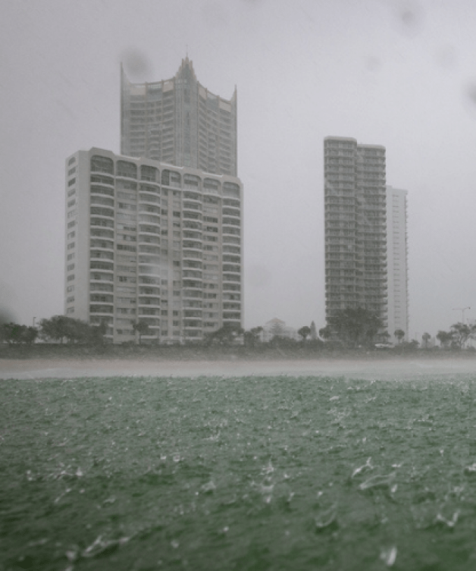
The Gold Coast and Tweed remain on flood watch this morning, despite missing the worst of the wet weather.
The city hasn’t been included in the latest severe weather warning, with most of the wild weather hitting further north.
Parts of Brisbane and Moreton Bay appear to have been the worst hit, with some areas recording 300 millimetres of rain in just three hours overnight.
The Gold Coast had initially been expected to cop more than 160 millimetres of rain from Monday to Wednesday, but that has now been revised down significantly to just 25mm.
However, authorities are urging residents not to be complacent.
“A slow-moving trough is forecast to become established within a very moist tropical airmass over southeast Queensland and northeast New South Wales during Monday into Tuesday,” the Bureau of Meteorology said.
“Enhanced widespread heavy shower and thunderstorm activity is expected within the vicinity of the trough from Monday through to Wednesday, with locally heavy rainfall likely.”
There are fears the rain will soak our already saturated rivers and creeks, leading to possible flash flooding.
“Inland catchments within the Flood Watch area are relatively dry, whereas the coastal catchments are generally wetter, especially those in southeast Queensland,” BOM said.
“Locally moderate to heavy rainfall is likely with showers and thunderstorms over the next few days. Some areas may receive heavy rainfall over consecutive days which will increase the flood risk.
“Widespread minor flooding is likely across the Flood Watch area from Tuesday, with locally moderate to major flooding possible in the areas of heaviest rainfall.”
Motorists hitting the road are also being urged to drive with caution and to flick their headlights on.